AI / GenAI2024Hackathon build· Smart India Hackathon 2024
PlotPatrol
Catching construction that drifts from its approved plan
First place at Smart India Hackathon 2024: a sensing pipeline that reconstructs what a building actually is, then argues with the plan the municipality approved.
01 Architecture
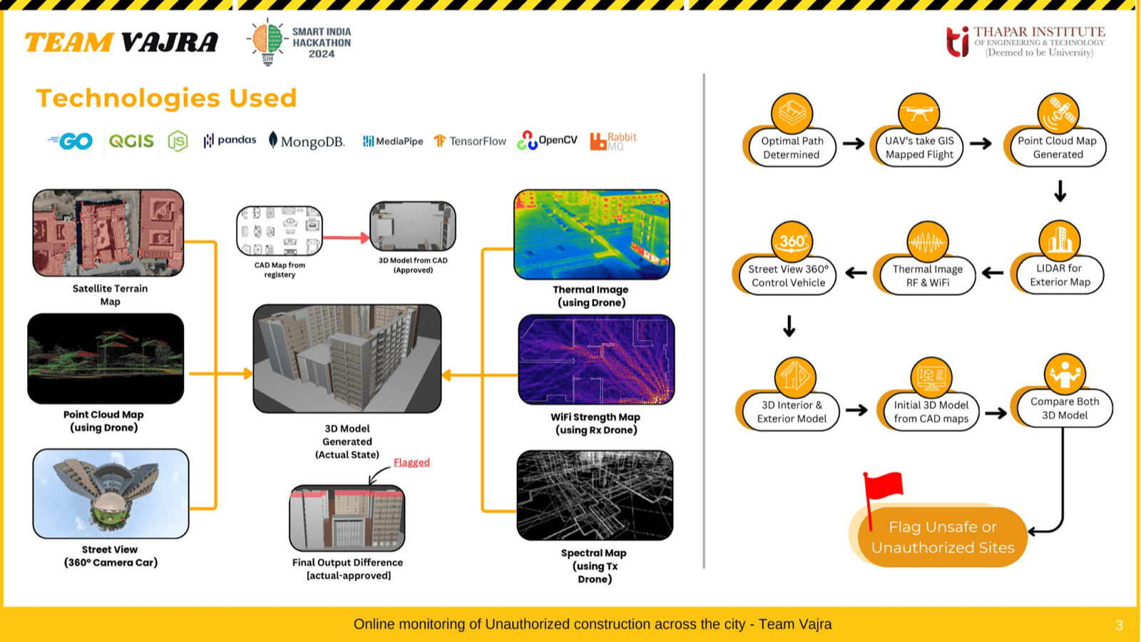
- Four independent sensing passes fused into one 3D reconstruction, so no single sensor has to be right on its own.
- Paired transmitter and receiver drones map interior structure through WiFi and RF behaviour where line of sight fails.
- LiDAR point clouds and thermal imaging cover exterior geometry, street view passes fill the facade.
- Satellite layer on Sentinel 2 composites: ResNet50 difference mapping plus SSIM analysis to score change between epochs.
- Reconstructed geometry registered against the council's approved CAD plans, so output is a ranked deviation list rather than a raw diff.
02 What is in it
- Won Smart India Hackathon 2024 on problem statement PS1618, at national level.
- Turns a manual on foot audit into a desk review with evidence attached.
- Detects vertical growth and footprint expansion that satellite imagery alone would miss.
- Built on Python, TensorFlow, Keras, OpenCV and Google Earth Engine.
Numbers
- 1st
- national, SIH 2024
- PS1618
- problem statement
- 4
- sensing modalities
Stack
PythonTensorFlowKerasOpenCVGoogle Earth EngineSentinel 2LiDAR
Availability
Hackathon buildBuilt for Smart India Hackathon 2024 and never hosted. It won the national round as a working prototype.